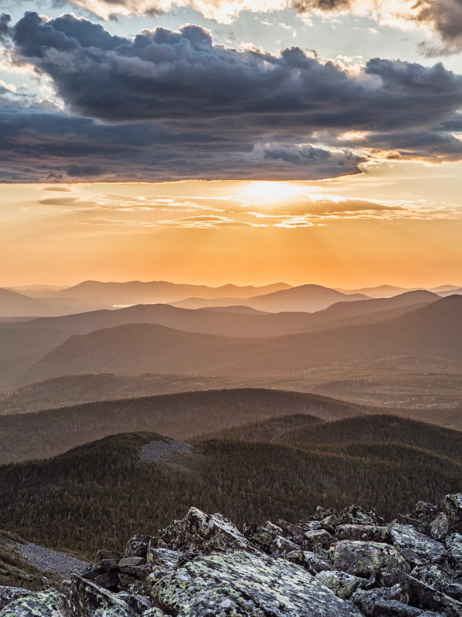
This summer Brian Ross completed a self supported 740 mile thru-paddle along the Northern Forest Canoe Trail in just 31 days. Follow with Eastward as we release his journal in segments over the next few weeks to recap his journey through remote NY, VT, Canada, NH, & ME.
- Know The Way -
Thought I was in for some smooth paddling through the deadwater on the Clyde River. I’ve been getting in and out of my boat for days now and lost my cool attempting to paddle up and over a low beaver dam. Frustrated and swearing at nothing in particular I hopped out into chest-deep water in order to slide my boat over this impediment and climb along behind. Still frustrated and distracted I leaned on the far gunnel of my boat while getting in and submerged the side. Opting to swim instead of flip the boat I collapsed into the water fully drenching myself now. This day got better when I missed a tributary leading to Island Pond and paddled for some distance past where I meant to be. Thankfully I was able to travel downstream when I realized my mistake and turned around. Little victories.
I stopped at Island Pond for a candy bar at the convenience store and was pleased to find they served breakfast. The day was looking up. This section of my trip was paired by a 3.3 mile carry through Brighton state park trails and over the train tracks. The portage passed a local airport where I was amused to see a grass runway and three hangers that were just a little larger than single-car garages. It’s abusively hot but I’ve been wearing sleeves and pants to keep the bugs away. I have yet to draw water and have been carrying gallons since Newport.
I cannot express how excited I am to travel with the current despite the boney conditions that necessitated my continued in and out to get over rocks and other low spots in the river. This is the Nulhegan. The watershed is very different than the muddy and sediment filled Clyde River. The river bottom is sandy in places and the topography is steeper. At the confluence with the Connecticut River I was leaving VT and entering NH.
My brilliant partner, Allie had been following my progress comparing it with her work schedule and had planned to have that evening off if I was available. We agreed to meet at a site downriver and she drove up from Massachusetts to spend the day and go into town. This was a most welcome experience especially after so many days of slogging upriver. I would highly recommend visits from loved ones if you’re in need or a morale boost.
I’m used to it by now and am developing a resilience to the constant stop/start of it all. The most exhausting part is that no momentum can be built in the winding sections. Each corner requires you to read the river for a passable section where you won’t run aground, stop when you run aground anyway and hope back in when it’s deep enough to paddle. On days like this I’m soaked by river water and sweat and find relief by laying down on the shallow gravel bars and letting pebbles build up against my body
Independence day-I didn’t make a journal entry today. It was hot, 91°. I covered very few miles and swam. Happy 4th.
I’m traveling to the Androscoggin River via a multi-mile portage. I’ve stopped looking at portage mileage on the maps. I’m resolved to tow or carry my gear and boat in the portage mindset until my boat is on the water once again.
This watershed is heaven despite the fact that I’m still heading upstream. It’s deep and wide with long sections of flat water. The class I rapids are deep enough with bountiful eddy’s to climb up like a ladder. Each eddy is a rung and allows me to ferry across to the next rung where I can make upstream progress. I switched to a large bladed, high angle paddle to capitalize on the deep water. People in floats and kayaks pass by in the opposite direction typically combined with jokes about how I’m “going the wrong way” or “facing backward”. It does look like a lot of fun though. The water is swift and safe with few technical whitewater features between 7 Islands Bridge and the State Park on Rte 16. One day I’ll come back here and float with the current I worked so hard to paddle against.
Goodbye New Hampshire, it’s been fun! I finished paddling the Androscoggin today, portaged through Errol and was on Lake Umbagog before the rain and lightning found me.
Lower Richardson Lake was very different. There were camps along the shores and powerboats towing screaming kids in tubes. I put my head down and paddled with the intention of covering many miles in the following hours. Despite my intention the headwind on the lake was unbearable and I commandeered a small island in the name of Brian Ross with a sandy beach to wait out the winds. As evening came and the headwind lessened I resumed my pursuit of mileage and eventually reached a northern island on Mooselookmeguntik where I called it a day.
This summer Brian Ross completed a self supported 740 mile thru-paddle along the Northern Forest Canoe Trail in just 31 days. Follow with Eastward as we release his journal in segments over the next few weeks to recap his journey through remote NY, VT, Canada, NH, & ME.
- Know The Way -